I remember the absolute terror of taxiing from one side of Chicago O'Hare to the other for the first time, trying to memorize the taxi route we expected versus the route we got. This was in a Gulfstream III before the days of EFBs and electronic charts. The other pilot knew exactly what was going on and carefully held the airfield diagram with his pencil following our progress.
— James Albright

Updated:
2018-11-20
These days, with either a moving map display on our cockpit avionics or an iPad, the terror is gone. But we still manage to find ourselves lost now and then. How is this possible and how do we prevent this?
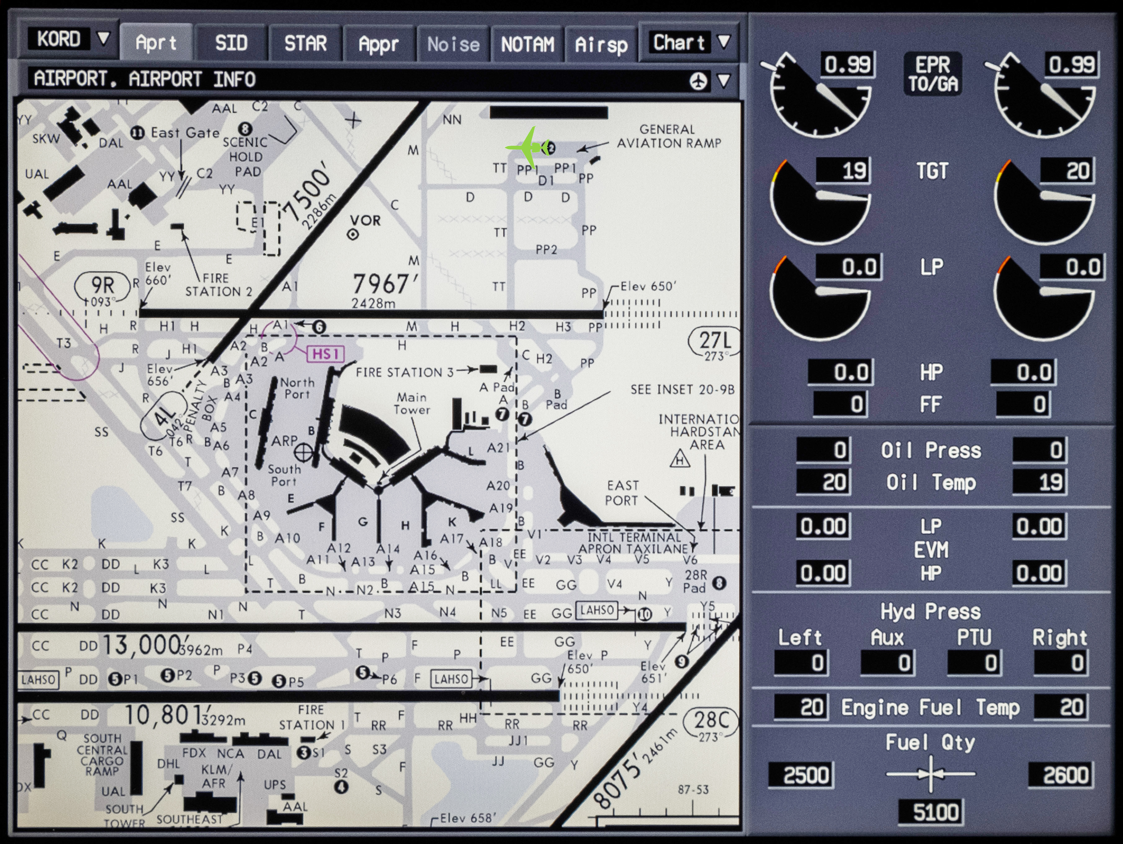
G450 display of Chicago O'Hare (KORD) taxi diagram, green aircraft symbol in GA ramp (top right)

Ideally, your cockpit avionics offer a scalable chart of the airfield diagram with an icon depicting your real-time position. You no longer worry about getting lost, now your biggest worry is heading in the right direction and avoiding a runway incursion.
A few years ago I was in O'Hare awaiting taxi clearance. I put the contract pilot in the left seat so I could provide what I hoped would be superior situational awareness in the right seat. Our taxi clearance came and it was about ten steps long. I wrote it down as quickly as the ground controller read it, so it wasn't the easiest to read scribble. Even on the best of days, the route to Runway 10L wasn't straight forward. But on this day we had a few taxiway closures to contend with. We were instructed to leave the general aviation ramp, make three turns, and then to enter Runway 9R, make a right turn, and then a left on the next exit. From there we had four more turns until a hold short point.
Just as we were about to enter Runway 9R I went "heads down" to check my notes. Just as I started to say, "It's a right turn," I felt the airplane turn left. Fortunately it wasn't terribly busy and our only penalty was to have ground control laugh at us. It could have been much worse. This is a high tech cockpit! How could we have prevented this?
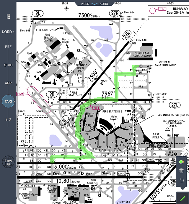
Jeppesen airfield diagram with O'Hare taxi route drawn out
I recommend you study the taxi chart before engine start to familiarize yourself with the route. With an iPad and Jeppesen FlightDeck, you can trace the route out too. If you have a cellular iPad or a portable GPS, your iPad can also display real-time positioning.
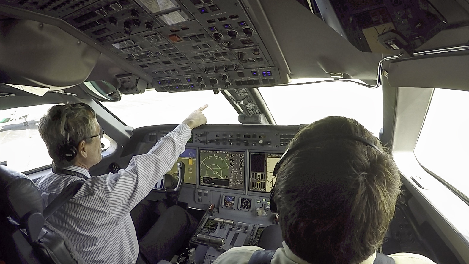
Calling out the next taxiway and direction of turn
You should also get in the habit of looking for the correct taxiway signs, pointing to them, and announcing your intentions before entering. For more about this technique, see: Pointing and Calling.